Once we’ve chosen a destination, the next step is to decide when we should go and the best way to get there. As with aviation, weather is the primary consideration when planning a sailing passage. There are many sources of weather information, and just as many ways of depicting that information, but we have found a few to be more informative and reliable than others.
When planning a passage, we begin by looking at a detailed 10-day weather forecast in Windy.com (and Windy.app) to get a big picture perspective of how weather will be evolving in the areas we plan to travel. Primarily, we look at wind direction, wind speed, and any low pressure systems that might bring adverse weather conditions. Of course, a sailboat relies upon wind to generate forward motion; however, too much wind and/or wind coming from the wrong direction may produce sea conditions that are hard on the boat, dangerous, or uncomfortable to the crew. Because Windy gives live worldwide weather reports from the most accurate weather models, we find this resource to be invaluable for sailing.
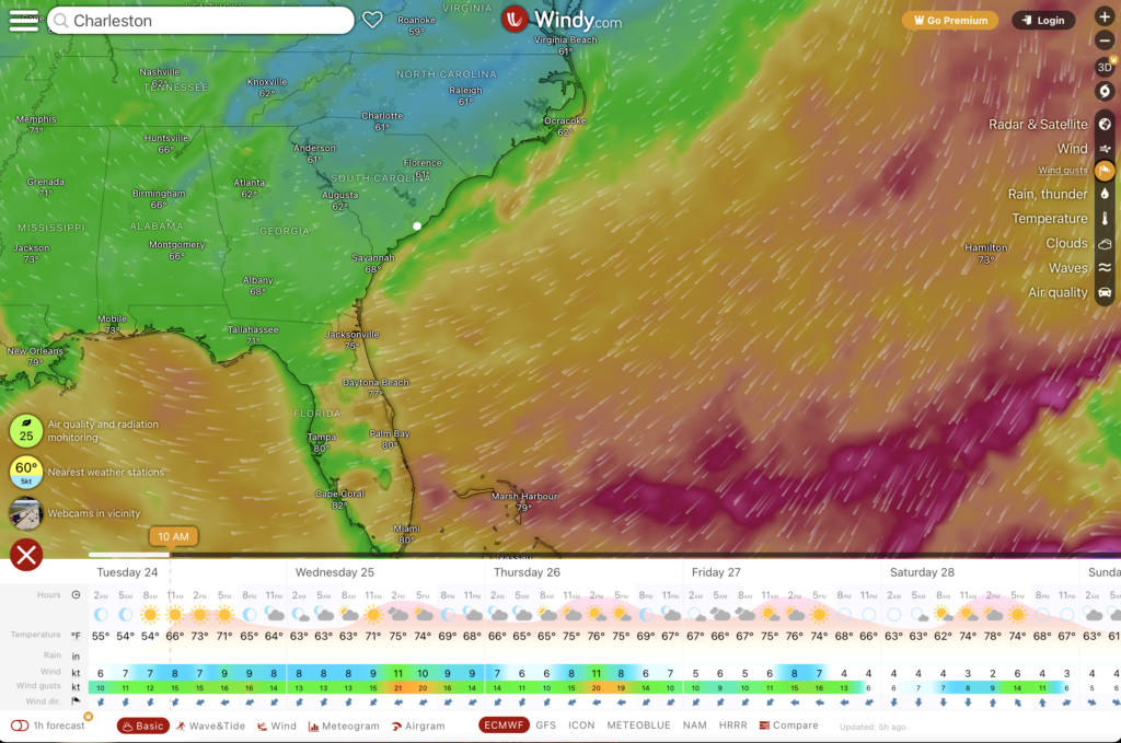
We have determined that perpendicular winds at 15-20 knots, with wave heights of 3-feet or less, are optimal for us. With waves larger than 3-feet, we prefer for them to be coming from behind us, pushing us along, as opposed to us bashing headlong into them. Not only is it an unpleasant ride, but it produces a great amount of stress on the boat and more chance of things breaking.
As our intended departure time nears, we look at various forecast models to discern which ones align most closely. In other words, we have found that the models that tend to agree with each other are the most accurate.
Once we have identified a safe and favorable weather window, we begin the route planning process. When it comes to route planning, there are a couple of considerations. The first factor is safety, and making sure that our route is free of obstacles and hazards.
The second factor to consider is efficiency. Although the shortest distance between two points is a straight line, that is not necessarily the most efficient course when it comes to sailing. The direction of wind relative to the boat’s heading is a primary consideration because it determines the true efficiency of progress toward our target. This factor is called Velocity Made Good, or VMG which is a mathematical equation [VMG=SOGxCosine (COG-TW)] used to determine the most effective sailing angle to the wind to give you the most efficient progress towards your target destination. A perfect VMG is when it is equal to your boat’s speed over ground.
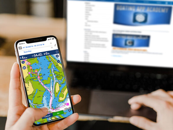
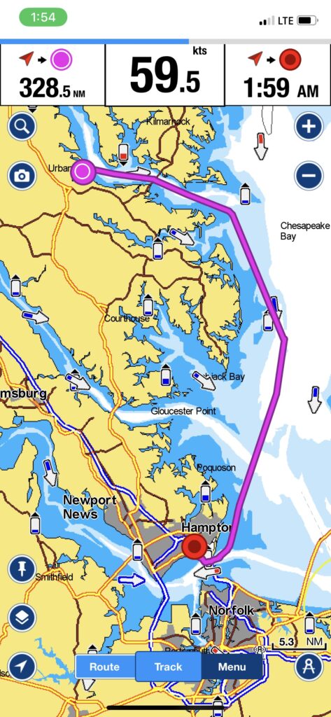
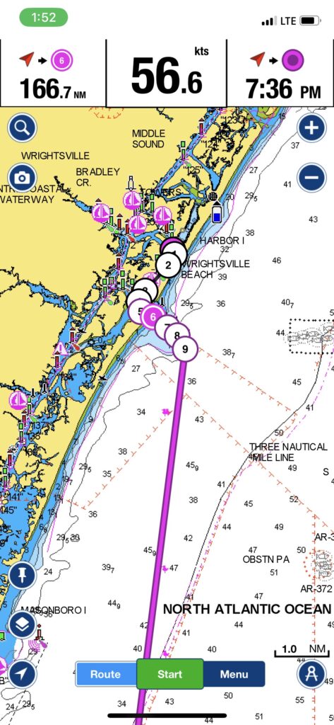
For route planning, we use an app called Navionics. This app combines current nautical charts, GPS positioning, and intelligent route planning capabilities all in one. We determine our starting point and desired destination and, from there, the app plots a course relative to the chart. This allows us to get a very accurate estimate of time, distance, and fuel consumption requirements for our planned route. The Navionics app integrates with our chart plotter and allows us to transfer the route right from the Navionics app to the chart plotter.
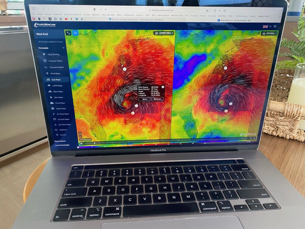
Another app that we are beginning to use more frequently is called PredictWind which is one of the highest resolution wind and marine forecasts on the web. PredictWind allows us to transpose the general points along our intended course and overlay forecasted wind and weather information so we can see where our boat will be along its course and what the forecasted weather conditions will be at any point in time. Another benefit of this app is that it has an intelligence engine that will take the performance data from our particular boat and couple that with forecasted wind speeds and directions, literally plotting our course to align with the most favorable winds and wind angles. We intend to use this resource more and more in the near future.
As we prepare for our trip to the Eastern Caribbean, I’m sure we will discover additional resources to aid us in our passage planning.